Analyse and digitize terrains before developing new photovoltaic plants
Drone or aircraft photogrammetry is ideal for analyzing and digitizing areas designated for photovoltaic plants, whether on land or rooftops. It enables detailed inspections and provides data for CAD and simulators, minimizing errors in the design and construction of new plants.

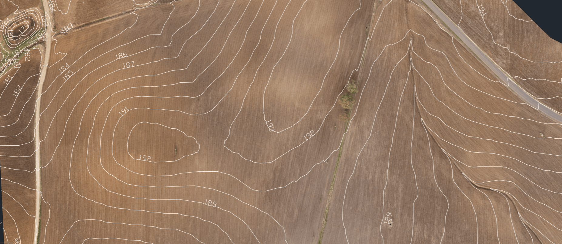
Advanced mapping
This solution provides highly precise area mapping, simplifying the evaluation of land conditions and identifying any requirements for earthwork adjustments.
How We Fly
Depending on your needs, we plan the inspection using aircraft or drones operated by professionals.
We offer the infrastructure to conduct aerial surveys independently with a hangar and a resident drone on-site.
Discover product
Dense Point Cloud
Ortomosaic
3D Model
DTM/DSM
Vectorialize
Water Basin Analysis
Overlay of Cadastral Maps
Digitization of Key Elements
Technical outputs for the design of the future site
Through our inspection, we deliver comprehensive technical outputs that outline the area's morphology and characteristics, assisting in identifying the ideal location for the new photovoltaic plant.
Solution benefit
Photogrammetry data provides a reliable foundation for CAD system design and delivers multiple advantages.
Accurate planning of construction phases.
Enhanced accuracy compared to traditional topographic surveys.
Minimized risks from working at heights, making it ideal for rooftop installations.
Efficient and comprehensive inspections of the targeted areas.
Access to customized reports and outputs, simplifying decision-making and operational processes.
DISCOVER WESII WEB PORTALTechnical outputs for the area.
Discover how we can help you analyse and digitize areas of interest before constructing new photovoltaic systems.
REQUEST INFORMATION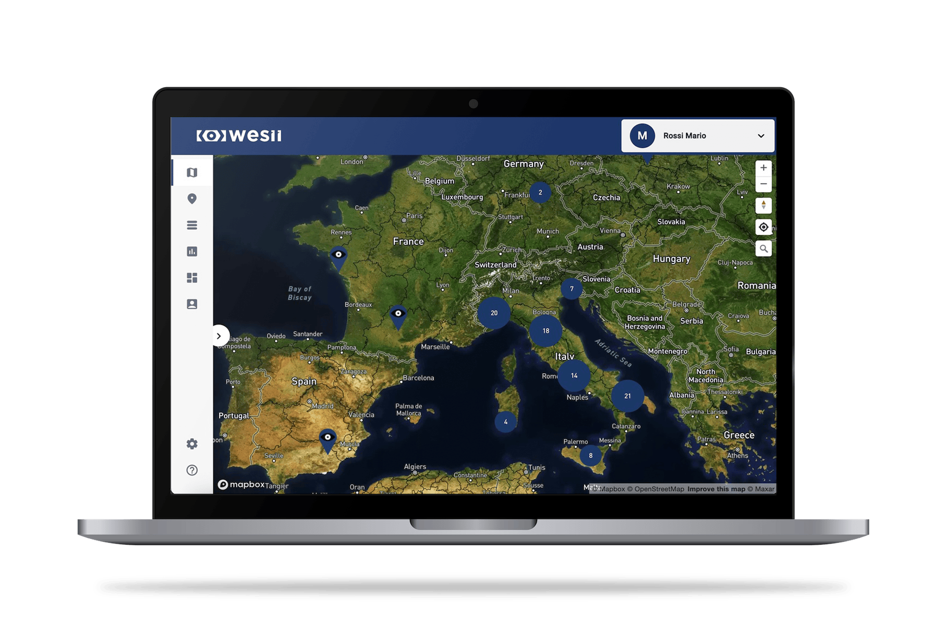
Access to data and customized reports directly from the Web Portal
The Wesii Web Portal centralizes all data from plants and sites, including analyses and serial numbers, providing access to customized reports and outputs, simplifying the decision-making and operational process.
Discover the Wesii Web Portal