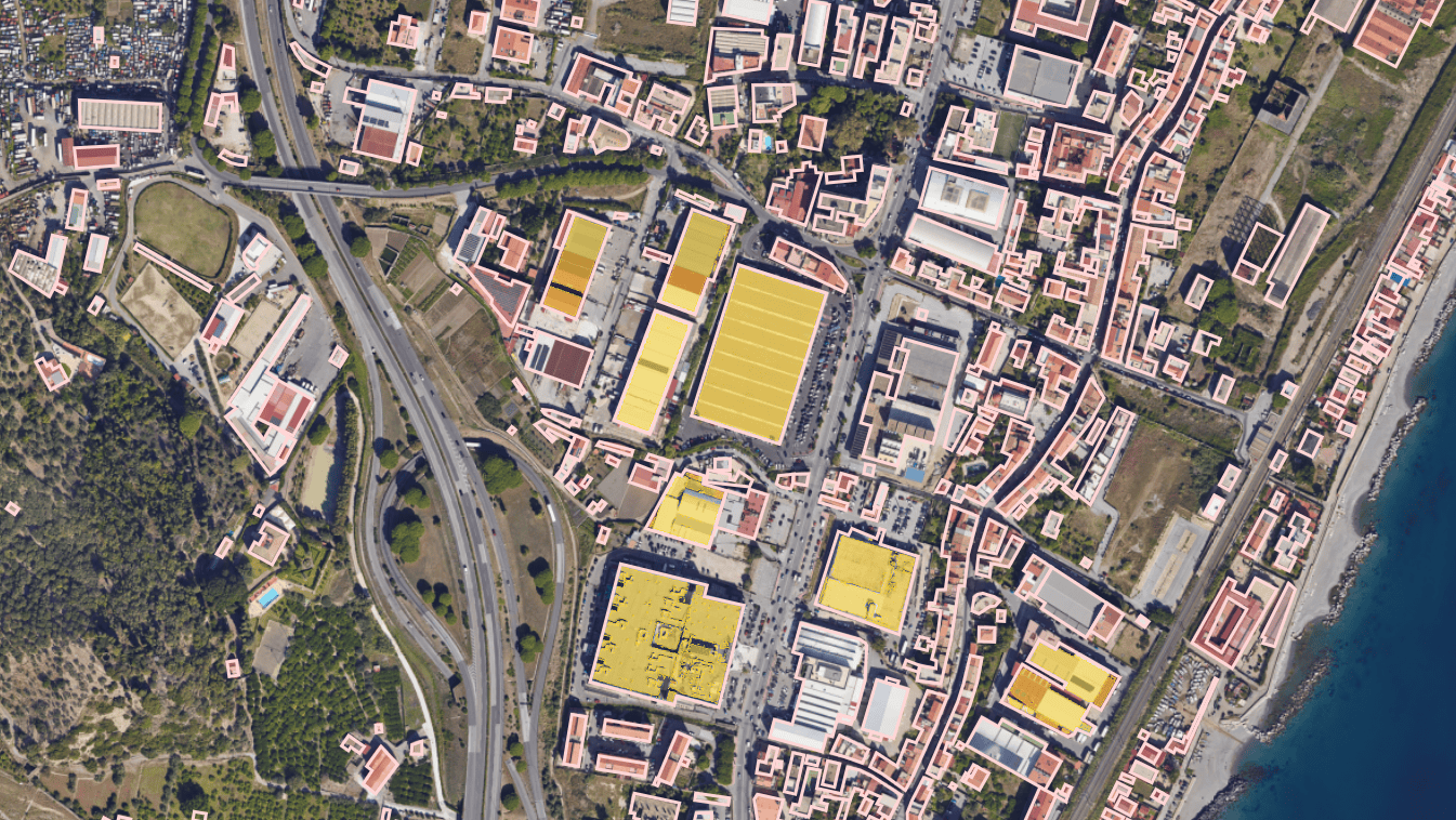
Photovoltaic potential mapping for commercial and industrial plants
Our multispectral mapping system identifies suitable surfaces for photovoltaic installations, optimizing areas and supporting Renewable Energy Communities (RECs), with a focus on industrial, commercial and public buildings.

Discover how to maximize the solar potential of your area
We provide detailed mapping of C&I surfaces to plan the installation of efficient photovoltaic systems, quantifying usable areas and solar irradiation potential. We validate surfaces for assets >50kWp, estimating annual energy production in kWh.
How We Fly
Depending on your needs, we plan the inspection using aircraft or drones operated by professionals.
We offer the infrastructure to conduct aerial surveys independently with a hangar and a resident drone on-site.
Discover product
Solution benefit
Maximizing photovoltaic potential: we provide analysis of high-potential areas for photovoltaic installations, maximizing energy output.
Cost reduction: roof analysis ensures lower costs and improved efficiency.
Energy sustainability: supporting CER on the path to a sustainable future.
Discover your company's solar potential with our advanced mapping
REQUEST INFORMATION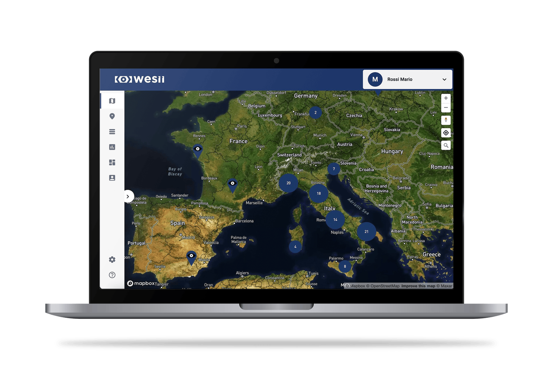
Access to data and customized reports directly from the Web Portal
The Wesii Web Portal centralizes all data from plants and sites, including analyses and serial numbers, providing access to customized reports and outputs, simplifying the decision-making and operational process.
Discover the Wesii Web Portal